How Jam-Packed Will My Train Be? Google Says It Has the Answer
June 27 2019 - 12:29PM
Dow Jones News
By Paul Berger
If you knew your regular, jam-packed commuter train is usually
followed by another one with empty seats, would you leave home 15
minutes later?
It is a question that Google Maps will hope to help answer with
a new rollout Thursday: a transit feature that predicts crowdedness
levels across mass transit in more than 200 cities, about
one-quarter of them in the U.S. The feature sweeps up large cities
from Los Angeles to New York as well as smaller ones such as
Champaign, Ill., and New Haven, Conn.
With the new feature, when a rider searches for directions in
Google Maps, the recommended routes will include predictions of how
crowded a particular bus, train, streetcar or ferry will be.
Taylah Hasaballah, a Google product manager in Sydney,
Australia, who oversees the project, said that in user research
crowdedness is one of the top concerns for Google Maps users when
making journey decisions.
"This feature is aimed at helping those users to make better
decisions and trade-offs about how they would like to move around
their city," Ms. Hasaballah said.
The predictions are based on crowdsourced information from
millions of riders world-wide, covering cities from Leeds, England,
to Pune, India.
Beginning in October 2018, Google asked certain users who
recently looked up directions or completed a trip to rate their
journeys. Riders were given four options: many empty seats; few
empty seats; standing room only; or cramped standing room only.
Google used the data it collected since October to build its
model of crowdedness across transit. It will continue asking the
question going forward to keep its data up-to-date.
Ms. Hasaballah said that figuring out how to collect and
aggregate the information wasn't simple, especially because
crowdedness is subjective. The ratings are user-generated, she
said, so each system's rankings are tailored to that region's idea
of what is considered empty or cramped.
Google has tested its predictions and found its accuracy is
fairly high, Ms. Hasaballah said.
A spokeswoman for Google, which is owned by Alphabet Inc., said
the crowdedness indicator is based on past performance, so it works
best when trains and buses run to schedule. The company sees the
indicator as a guide similar to Google Maps' "popular times"
feature, which tells people how busy bars, restaurants and other
venues are at different hours of the day.
Madeleine Koestner, a consultant who commutes to New York City
from New Jersey, said Google's new service is perfect for her. Ms.
Koestner, who is 31, said she already takes slower subway lines
when she knows that a faster train on another line will be
packed.
But Julia Strapp, a lighting designer from Queens, N.Y., said
she wouldn't find the function useful. She just squeezes onto the
first subway train that comes because she has no choice. "If it's
crowded, it means it's rush hour," she said.
Chris Stocking, a spokesman for Clevelanders for Public Transit,
said riders in his city are more concerned about rising fares and
service cuts than they are about crowdedness. "We just want a bus
that comes frequently, that gets us where we need to go in an
affordable way," Mr. Stocking said.
Google will also release a new map feature Thursday showing
estimated bus journey times.
Many U.S. transit agencies already provide real-time bus travel
feeds to Google. But for those that don't, in cities such as
Atlanta, Google will predict travel times.
The Google spokeswoman said the company generates the estimates
by combining route information, such as the number of bus stops and
bus lanes, with live traffic conditions and anonymized data from
users with location services turned on.
Write to Paul Berger at Paul.Berger@wsj.com
(END) Dow Jones Newswires
June 27, 2019 12:14 ET (16:14 GMT)
Copyright (c) 2019 Dow Jones & Company, Inc.
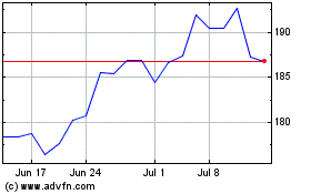
Alphabet (NASDAQ:GOOG)
Historical Stock Chart
From Aug 2024 to Sep 2024

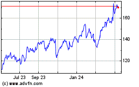
Alphabet (NASDAQ:GOOG)
Historical Stock Chart
From Sep 2023 to Sep 2024
