New Silver-Lead Mineralization Discovered
December 10 2007 - 2:55PM
Marketwired
VANCOUVER, BC (OTCBB: KLSVF) is pleased to announce the
successful completion of this year's exploration program at the
Connaught (CN) property, which is under option from ATAC Resources
Ltd. The property hosts an extensive system of silver-lead-gold
veins located within the Sixtymile Placer Gold Camp, 65 km due west
of Dawson City in western Yukon Territory. It is accessed by
four-wheel drive truck via the Sixty Mile Road off the Top of the
World Highway, which extends from Dawson City west into Alaska. The
property is being explored as a high grade lead-silver vein target
modeled after the highly productive Keno Hill district located 250
km to the east.
Terrain in the vicinity of the claim block is subdued with
gentle to moderate slopes flanking broad rounded hilltops. Outcrop
is confined to isolated tors on ridge crests. Geology consists
primarily of metasediments belonging to the Fortymile River and
Klondike Schist Assemblages that are in thrust contact with the
South Fiftymile Batholith. The metasediments are dominantly
quartz-mica schist while the batholith is comprised of quartz
monzonitic to granitic gneiss. Historical work began in the early
1960s and continued intermittently through the mid 1980s. During
that time, exploration consisted of grid soil geochemical sampling,
ground geophysical surveys, bulldozer trenching and limited diamond
drilling. It identified numerous lead-in-soil geochemical anomalies
and seven silver-lead-gold bearing veins (referred to as #1 through
#7) within a 13 km by 5 km area that is now mostly covered by the
CN property. Approximately 218 tonnes of galena/anglesite rich
material is reported to have been collected from the #1 and #3
Veins and shipped to the Cominco smelter in 1976. The shipment
reportedly averaged 2228.5 g/t (65 opt) silver, 60% lead and 1 g/t
gold.
The vein zones are commonly associated with northeast trending,
weakly to moderately recessive weathering lineaments. Where
exposed, the veins are typically 0.3 to 2 m wide and grade 100 to
1000 g/t silver with 0.3 to 2 g/t gold. Lenses of nearly massive
silver-rich galena are developed locally within the vein
structures. Most veins exhibit coarse, comb textured,
multi-episodic quartz hosting varying amounts of galena, anglesite,
arsenopyrite, scorodite, covellite, and stibnite.
The 2007 exploration program at the CN property followed a
property wide, airborne VTEM survey conducted in 2006. The work
consisted of prospecting, grid soil sampling, approximately 1100 m
of excavator trenching and 566 m of diamond drilling. Most of this
work was directed toward better establishing the tenor of
mineralization at the known vein zones.
Four historical vein zones were relocated and sampled. Excavator
trenching in the vicinity of the #1, #3, #4 and #7 veins located
significant mineralization on the floor of an old trench at the #3
Vein and discovered two promising lenses in new trenches near the
#7 Vein. All of these occurrences consist of massive
anglesite/galena in lenses, which have been exposed for widths up
to 1.25 m and along strikes for up to 16 m. Approximately two
tonnes of massive galena were recovered from the soil during the
exploration of the newly discovered lenses. Closely spaced sawn
channel samples were collected along each of the vein exposures to
establish grade control.
A total of seven diamond drill holes tested at shallow depths
beneath the #1, #3 and #4 veins. Mineralized vein material was
encountered in all holes. No drilling was done in the vicinity of
the newly discovered lenses near the #7 vein because they were
discovered after the drill program was completed. All assays from
the 2007 trenching and drilling are pending.
Only 30% of the property has been grid soil sampled, and
trenching and diamond drilling have tested only a small proportion
of the existing soil geochemical anomalies. A compilation of soil
geochemical results from 1969 to 2007 has identified ten northeast
trending linear lead-in-soil anomalies ranging in length from 200 m
to > 2000 m. Four of the known vein zones coincide with portions
of these anomalies. Statistical analysis shows that lead is highly
correlated with silver. The anomalous linear trends are defined by
lead values greater than 100 ppm. The highest lead- and silver-in
soil values (6600 ppm and 24.9 ppm, respectively) were obtained
from the 2007 program.
Richard Hughes states, "There is excellent potential for
additional discoveries both on the CN property and the newly
acquired Mag claim block which adjoins the CN claims to the east
(see News Release dated November 11, 2007)." The Mag claims host
another well mineralized vein zone referred to as the #8 Vein which
was discovered by bulldozer trenching in 1969. Vein mineralogy is
similar to the veins exposed on the CN property and reported
historical grades for galena-dominant samples collected
intermittently along a 275 m strike length range from 723 g/t to
5498 g/t Ag with lead values up to 84.65%. Table I lists historical
results for samples collected in 1988 along the #8 Vein.
Table I - #8 Vein

-------------------------------------
Length along Vein    Ag(g/t)    Pb(%)
-------------------------------------
       0 m            1965      64.00
-------------------------------------
      25 m            2500      72.30
-------------------------------------
     112 m            1632      75.00
-------------------------------------
     130 m            5498      78.76
-------------------------------------
     143 m            1901      84.65
-------------------------------------
     275 m             723      22.30
-------------------------------------
All analyses for the 2007 program are being performed at ALS
Chemex laboratory in North Vancouver using industry-standard fire
assay and ICP techniques. This laboratory carries ISO 9001:2000
registration and is accredited to ISO 17025 by Standards Council of
Canada for a number of specific test procedures including fire
assay Au by AA, ICP and gravimetric finish, and multi-element ICP
and AA assays for Ag, Cu, Pb and Zn.
The exploration program at the CN property is being carried out
under the supervision of Bill Wengzynowski, P.Eng, President of
Archer, Cathro & Associates (1981) Limited.
The technical information in this news release has been prepared
in accordance with Canadian regulatory requirements set out in
National Instrument 43-101. Mr. Wengzynowski is designated as the
qualified person who reviewed this information.
On behalf of the Board of Directors
KLONDIKE SILVER CORP.

"Richard W. Hughes" (signed)
President
For Further Information Contact: The Hughes Exploration Group at
(604) 685-2222 or visit the Company's website:
www.klondikesilver.com to see the Smartstox Report in which Stanlie
Hunt interviews Klondike Silver Corp. President Richard Hughes.
This document contains certain forward-looking statements which
involve known and unknown risks, delays and uncertainties not under
the corporation's control which may cause actual results,
performance or achievements of the corporation to be materially
different from the results, performance or expectation implied by
these forward-looking statements.
The TSX Venture Exchange has not reviewed and does not accept
responsibility for the adequacy or accuracy of this news
release.
Klondike Silver Corp.
#711-675 WEST HASTINGS STREET
VANCOUVER, B.C.
CANADA V6B 1N2
TELEPHONE: (604) 685-2222
FAX: (604) 685-3764
www.klondikesilver.com
Distributed by Filing Services Canada and retransmitted by
Marketwire
Contact: The Hughes Exploration Group (604) 685-2222
www.klondikesilver.com
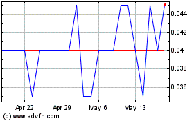
Klondike Silver (TSXV:KS)
Historical Stock Chart
From Jun 2024 to Jul 2024

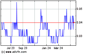
Klondike Silver (TSXV:KS)
Historical Stock Chart
From Jul 2023 to Jul 2024
