Liberty Star’s Hay Mountain ZTEM Program Expanded & Flight Commenced
June 18 2013 - 10:05AM
Business Wire
Liberty Star Uranium & Metals Corp. (“Liberty Star” or the
“Company”) (LBSR: OTCQB) is pleased to announce that the current
ZTEM flight plan has been expanded from 786.3 line kilometers (@200
m line spacing) to 1805 line kilometers (@200 m and @400 m line
spacing). The 786.3 km @200 m line spacing is over Hay Mountain
proper and other critical areas, while the 400 km line spacing is
related to reconnaissance surveying over prospective ground. This
has resulted in more than double the size of the survey area and a
reduction in the cost per flight kilometer of about 11%. This
survey now covers the entire Tombstone caldera east of the San
Pedro River, Cochise County, Arizona.
The fixed wing overflight (NR 151) has commenced over the Hay
Mountain property as of Monday morning, June 17th, 2013. The
flight line readings will investigate the geophysical response as a
single block measuring the surveyed area. According to
Geotech, their proprietary receiver design using the advantages of
modern digital electronics and signal processing delivers
exceptionally low-noise levels. The result is unparalleled depth of
investigation in precision electromagnetic measurements with a
geophysical measurement every 8.5 meters along the lines and a
penetration of approximately 6,000 feet below the land surface.
Liberty Star’s target elements are gold, copper, moly, silver, rare
earth metals, lead and zinc, along with other byproduct metals
occurring in a porphyry gold copper environment, as indicated by
Liberty Star’s detailed geologic and geochemical survey results (NR
127).
ZTEM Update:
As of June 17th Geotech staff reports that testing at its
recoding base on Federal land within the Hay Mountain area is
completed. The US Army base at Ft Huachuca granted permission for
test flights this past Saturday and Sunday, June 15th and 16th. All
the test flights proved satisfactory: data collection overflights
commenced on Monday, June 17th. The speed of completion of the
survey will be dependent on how many flying hours are available
each day. This is now monsoon season in southeast Arizona, and
the survey craft cannot be flown during periods of turbulent air
due to heat and thunderstorms. Flights will start at daybreak
and terminate either at dusk or when turbulence is encountered.
“James A. Briscoe” James A. Briscoe, Professional Geologist, AZ
CACEO/Chief GeologistLiberty Star Uranium & Metals Corp.
Forward-Looking Statements
Statements in this news release that are not historical are
forward-looking statements. Forward-looking statements in this news
release include our exploration plans, that ZTEM will be flown over
the Hay Mountain and other critical areas. Factors which may delay
or prevent these forward-looking statements from being realized
include: we may not be able to raise sufficient funds to complete
our intended exploration, keep our properties or carry on
operations; there may be cost overruns; misinterpretation of data
is possible; and we may be unable to continue exploration due to
permitting requirements, weather, logistical problems, labor or
equipment problems or hazards even if funds are available. Despite
encouraging data there may be no commercially exploitable
mineralization on our properties. Readers should refer to the risk
disclosures in the Company’s recent 10-K and the Company’s other
periodic reports filed from time to time with the Securities and
Exchange Commission.
Liberty Star Uranium & Metals Corp.Tracy Myers,
520-425-1433Investor Relationsinfo@LibertyStarUranium.comFollow
Liberty Star Uranium & Metals Corp. on Facebook & Twitter
@LibertyStarLBSR
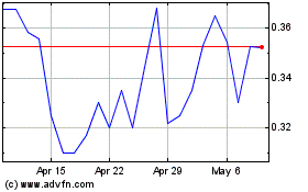
Liberty Star Uranium and... (QB) (USOTC:LBSR)
Historical Stock Chart
From Apr 2024 to May 2024

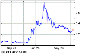
Liberty Star Uranium and... (QB) (USOTC:LBSR)
Historical Stock Chart
From May 2023 to May 2024
