Samsara and Esri Launch New Integration to Transform Public Sector Fleet Operations
September 30 2024 - 9:00AM
Business Wire
Samsara Inc. ("Samsara") (NYSE: IOT), the pioneer of the
Connected Operations® Cloud, today announced a new integration with
Esri to enhance fleet management and real-time reporting for
government agencies. This turnkey integration allows customers to
leverage telematics data from Samsara, including location,
utilization, and maintenance, within Esri’s® ArcGIS® Velocity℠, a
software-as-a-service IoT application for processing, visualizing,
and analyzing real-time data. With these consolidated insights,
public sector organizations can elevate citizen services, drive
operational efficiency, and keep their communities safer.
This press release features multimedia. View
the full release here:
https://www.businesswire.com/news/home/20240930223379/en/
Samsara and Esri Launch New Integration
to Transform Public Sector Fleet Operations (Graphic: Business
Wire)
Public sector fleets often struggle with siloed systems and
manual reporting processes that are cumbersome and time-consuming.
This can cause data quality issues across departments and hinder
their ability to make accurate, timely decisions. Integrating
telematics insights from Samsara with Esri’s ArcGIS Velocity gives
these organizations a more complete view of their fleet operations
to eliminate data silos, gain real-time visibility, and increase
efficiency.
Esri, the global leader in geographic information system (GIS)
technology, provides mapping and spatial analytics tools to enhance
decision-making and operational excellence for organizations across
industries, as well as federal, state, and local governments. The
combined capabilities of Samsara and Esri’s ArcGIS Velocity allow
customers to ingest, analyze, and visualize real-time location and
condition data, offering these key advantages:
- Enhanced Asset Recovery: Streamlined and efficient
processes for geofencing, asset tracking, and recovery.
- Optimized Emergency Response: Faster, more accurate
response times to emergencies with GPS and location data
integration.
- Comprehensive Post-Event Reporting: Detailed reporting
that supports transparency and accountability within government
operations.
“Our partnership with Samsara allows ArcGIS users to combine
critical IoT data points with their geospatial system of record for
a more complete view of fleet operations and management,” said
Thomas Fair, Director of Esri Partner Network. “By consolidating
these insights, we’re empowering our users to make faster, more
informed decisions and have a greater impact on the communities
they serve.”
Samsara offers technology solutions to state and local
governments nationwide, helping them boost service transparency,
improve safety, and enhance sustainability. With over 290 partner
integrations, its App Marketplace is the largest open ecosystem for
physical operations.
“In government services, safety and efficiency are everything.
From emergency dispatch to snow plow operations, every second
counts,” said Robert Williams, Director, Public Sector Partnerships
at Samsara. “We’re excited to partner with Esri to broaden
Samsara’s reach within the public sector and provide real-time
insights that are tailored to the unique needs of these fleet
operations. I look forward to seeing what our customers accomplish
with this new integration.”
Samsara’s integration with Esri’s ArcGIS Velocity is now
available globally to customers. To learn more, visit the Samsara
App Marketplace.
About Samsara
Samsara (NYSE: IOT) is the pioneer of the Connected Operations®
Cloud, which is a platform that enables organizations that depend
on physical operations to harness Internet of Things (IoT) data to
develop actionable insights and improve their operations. With tens
of thousands of customers across North America and Europe, Samsara
is a proud technology partner to the people who keep our global
economy running, including the world’s leading organizations across
construction, transportation and warehousing, field services,
manufacturing, retail, logistics, and the public sector. The
company's mission is to increase the safety, efficiency, and
sustainability of the operations that power the global economy.
Samsara is a registered trademark of Samsara Inc. All other
brand names, product names or trademarks belong to their respective
holders.
About Esri
Esri, the global market leader in geographic information system
(GIS) software, location intelligence, and mapping, helps customers
unlock the full potential of data to improve operational and
business results. Founded in 1969 in Redlands, California, USA,
Esri software is deployed in hundreds of thousands of organizations
globally, including Fortune 500 companies, government agencies,
nonprofit institutions, and universities. Esri has regional
offices, international distributors, and partners providing local
support in over 100 countries on six continents. With its
pioneering commitment to geospatial technology and analytics, Esri
engineers the most innovative solutions that leverage a geographic
approach to solving some of the world’s most complex problems by
placing them in the crucial context of location. Visit us at
esri.com.
View source
version on businesswire.com: https://www.businesswire.com/news/home/20240930223379/en/
Media Contact Andie Rodriguez Samsara
media@samsara.com
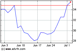
Samsara (NYSE:IOT)
Historical Stock Chart
From Oct 2024 to Nov 2024

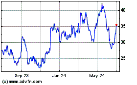
Samsara (NYSE:IOT)
Historical Stock Chart
From Nov 2023 to Nov 2024
